Two great Mourne Mountain challenges: two long-running numerical errors in need of correction.
The Mourne Mountains are one of the closest upland ranges to where I live. From my home in Belfast, I can drive to most walk start points in the Mournes in under an hour. There aren’t many paths, tracks and trails in the range that I haven’t walked and, as a self-confessed map addict, I’m sure very few people will have studied the Mourne maps in as much detail as I have.
It is through these map studies that I have discovered two mythical measurements hiding in two of the Mourne Mountain’s greatest walking challenges. One a height, the other a distance. Both of which have been widely accepted as facts for too long.
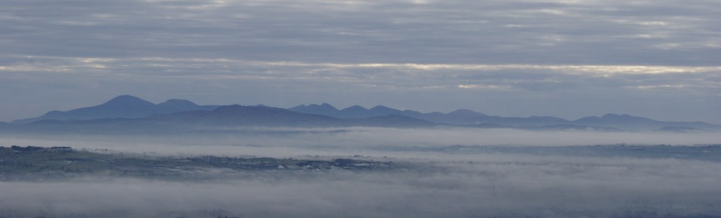
The Mourne Mountains viewed from the Belfast Hills
1. The Mourne Sevens
(one of the seven Sevens is not a Seven)
On two occasions (first in 2004 and again 2007), I have taken part in (and completed) the long-running annual challenge often referred to as the Mourne Seven Sevens. From herein, I will refer to the challenge as the more-correctly titled “Mourne Sevens”.
The Mourne Sevens is widely regarded as one of Ireland’s finest one-day mountain challenges. Having taken part in the event twice myself, I can confirm that it is a great challenge and would thoroughly recommend it. The objective is to start from Donard Park in Newcastle and visit all the 700m+ summits in the Mourne Mountains before returning to Donard Park. The summits are:
- Slieve Donard (850m)
- Slieve Commedagh (767m)
- Slieve Binnian (747m)
- Slieve Bearnagh (739m)
- Slieve Meelbeg (702m)
- Slievelamagan (702m)
The error
When the Mourne Sevens was first staged, the latest version of the Mourne Country Outdoor Pursuits Map at the time showed a seventh 700m+ spot height (704m) at the summit of Slieve Meelmore. Based on this published information, the original organisers of the Mourne Sevens quite legitimately included Slieve Meelmore in their annual challenge as the seventh Seven. Afterall, why would they suspect there to be such a big error on a published map.
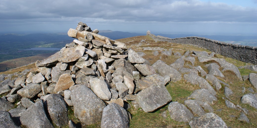
Cairn marking the 680m summit of Slieve Meelmore
When I was preparing for the 2004 Mourne Sevens I studied my own copy of the Mourne Country Outdoor Pursuits Map (pub. 1992). As I assessed the possible route options for the upcoming challenge, I noticed something very odd about the summit of Slieve Meelmore. It had the 704m spot height marked, yet the highest contour on the mountain had a value of just 680m. The contour interval on the map was 10m, but the 690m and 700m contours were not shown. Either the contours were wrong or the spot height was wrong. My suspicion was the spot height.
Next time I was on Slieve Meelmore, I took a GPS reading at the summit using a Garmin Etrex. The elevation recorded was 685m to an accuracy of 6m. Based on this crude but adequate survey, Slieve Meelmore’s elevation could not be more than 691m – that’s at least 9m short of being a true Seven. Even if a datum adjustment of 2.7m* were required, it would not be enough to bring Slieve Meelmore above the magical 700m barrier.
* According to the Ordnance Survey Ireland website, Malin Head datum is approximately 2.7m higher than Poolbeg datum.
Later editions of the Mourne Country Outdoor Pursuits Map and it’s successor, the Mourne Activity Map, have all shown Slieve Meelmore summit to be well under 700m. I have pointed out this error to the original and present organisers of this great event in the hope that they will rename it accordingly. Although both are aware of the error (they mention it in the “small print” on their websites), neither has opted to make this very basic change. For some unknown reason, “tradition” appears to be more important than truth.
The height of Slieve Meelmore’s summit is now widely accepted as being somewhere between 679m and 691m (that’s between 9m and 21m short of being a true “Seven”!).
It is disappointing to still see completers of this challenge writing online about having visited all seven of the 700m+ summits in the Mourne Mountains. It would appear that the truth mentioned in the “small print” has gone unnoticed and that the challenge’s title continues to mislead. It is time for the new organisers to finally rename this great event and give it the honest title it deserves: The Mourne Sevens.
The solution
This is a very simple one to correct. All the organisers need to do is rename the event as the Mourne Sevens from 2020 onwards. If they can do that, I will be signing up for my third Mourne Sevens as soon as registration opens.
The Irish hillwalking community also has a part to play in getting rid of this error. Talk about the Mourne Sevens (not the Mourne “Seven” Sevens), and use accurate hashtags on social media (e.g. #MourneSevens and #Mourne7s).
You may be interested to know that the six true 700m+ summits now feature exclusively together for the first time in the Mourne 700s Challenge. This is one in a set of 17 anytime Irish hillwalking challenges recently announced by The Ireland Walking Guide website.
2. The Mourne Wall
(it is less than 90% as long as is claimed by most sources)
Since taking up hillwalking in 1997, I have walked the entire length of the Mourne Wall. But never all in one outing, although I have often considered it. Hopefully, I will get around to that challenge one day.
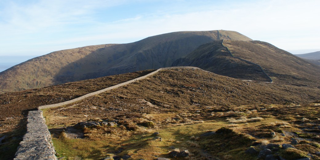
The Mourne Wall
In my early hillwalking days, I noticed that the Mourne Wall was often being described as 22 miles (35.4km) long. I thought little about that and just accepted it as a well-researched fact. But that acceptance diminished after I bought a copy of Paddy Dillon’s The Mournes Walks book.
In this book, Paddy describes a 20-mile (32.2km) circular walk along the Mourne Wall starting and finishing at Silent Valley car park. 20 miles? But everyone else was saying 22 miles. A difference of 2 miles. How could that be? I couldn’t just let that one go. If people were being misinformed, I couldn’t just allow it to continue.
I measured the Wall’s length as accurately as I could using my copy of the Mourne Country Outdoor Pursuits Map. This crude method produced a measurement of less than 19 miles (30.6km). 3 miles less than the widely-accepted length.
At my place of work, I had access to computer-aided-design software and digital mapping data. So, I plotted the Wall’s route precisely on the computer. I even constructed it in 3D to allow for additional sloped distances. And the exact length of the Mourne Wall? 19.5 miles (31.4km).
On Twitter, in 2013, I also asked participants in the Mourne Wall Walk event to record the route using GPS.
The organisers came back to me, quoting a GPS-measured length of 33km (20.6 miles), although this included a substantial diversion which added a mile to their route. Without even having to factor in the accuracy of their handheld GPS device or the strength of signal from the satellites, this evidence backed up the 19.5 mile length I measured using high-precision digital mapping.
Routes recorded by other hillwalkers using smartphones and handheld GPS have also been posted online. These all serve as additional evidence of the error I am highlighting. Even those which do not precisely follow the actual course of the Mourne Wall prove that the often-quoted 22 miles is wrong.
It should be noted that distances recorded using smartphones and handheld GPS devices are far less accurate than those measured using large-scale Ordnance Survey 3D digital mapping. Smartphones and handheld GPS devices are only accurate to several metres depending on satellite signal strength. As a result, tracks recorded using these devices will ‘dither’ a few metres back and forth along the entire route, generating a notable error in the overall distance. Over the length of the Mourne Wall, this could easily add an extra half mile. It is also questionable how accurately, or even if, these consumer-grade devices translate slopes into the distances they record. This has been pointed out to me by a very helpful challege walker who has recorded tracks using handheld GPS devices and smartphone apps.
Digital mapping, on the other hand, has been produced using commercial-standard GPS equipment, total stations and photogrammetry. The mapping generated using these methods by highly-trained professionals equipped with state-of-the-art technology is accurate to a few centimetres or even millimetres. Nowadays, consumers can access this data to take precise measurements, as I have done for the Mourne Wall.
Check it out for yourself by going to the map viewer on the SpatialNI website. There you can draw a polyline along the entire Mourne Wall and view its flat length. Follow these steps:
Go to the SpatialNI website >> select “Map Viewer” from the “Maps” pull-down >> read and agree to terms and conditions >> zoom in to a point along the Mourne Wall >> select the “Draw and Measure” option (paint and brush symbol) >> select “Polyline” (zigzag symbol) >> flick on the”Show length measurement” setting (this is very important >> trace the line of the Mourne Wall as precisely as possible (best to use a mouse for this) >> double-check last point and zoom out to display the Mourne Wall’s flat length quoted.
What caused this error?
It is unclear how or why this error first arose. 2.5 miles is quite a whopper of a mistake to have gone unnoticed by so many for so long. To put it another way, it’s an extra 13%. The most likely cause, I suspect, was that an earlier Mourne Wall walk description quoted “22 miles” as the overall route length including approach and exit sections. For some reason, this must have been misinterpreted as being the Wall’s length, then published somewhere, and blindly accepted as fact.
The solution
This one is a bit more difficult to put right because the wrong length is quoted on so many websites. Even the BBC have used the wrong figure several times in their news stories.
The solution is to contact the content manager of every website which contains the error and ask them to correct it. There are so many to contact, and it could take me a while to go through them all by myself. Next time you see the “22 miles” length quoted for the Mourne Wall, feel free to contact that website’s content manager yourself and direct them to this blog post. By working together, we can remove this common error from the internet completely.

One thought on “Mourne Mountain mythical measurements”